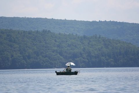
Fishing on the Pepacton Reservoir: Has that umbrella been steam-cleaned? Photo taken July 17, 2013; from the New York City Department of Environmental Protection's Flickr page.
In the past few years, there's been a shift of attitude at the New York City Department of Environmental Protection (DEP), where officials are increasingly rolling out a welcome mat for hikers, boaters, anglers and hunters who want to use city property. On lands near the city's west-of-Hudson reservoirs, where once hiking groups had trouble even getting permission to cross DEP property, the agency is now actively working with hiking groups to build trails.
In 2013, the DEP announced this week, almost 6,000 acres of city-owned land were opened to recreational access. Most of the new access is on lands that do not require a permit. In a news release, the agency touted the opening of more watershed lands, as well as some of the city's new 2013 programs to increase access: A program to allow licensed hunting and fishing guides to lead tours on DEP property, the advent of rental boats stored at four of the reservoirs, and some new trail-building initiatives with the Catskill Mountain Club and the Finger Lakes Trail Conference.
Among the trails that have sprung up on DEP property in the past year is a new 5.3-mile round-trip trail in Andes with sweeping views of the Pepacton Reservoir, the Shavertown Trail. North of the Cannonsville Reservoir, the Finger Lakes Trail Conference has moved 9.5 miles of trail that used to run alongside public roads, relocating them to old trails that run through city-owned fields and forests. This trail is part of the Long Path, a segment of the more than 950 miles of trail that make up the Finger Lakes Trail system.
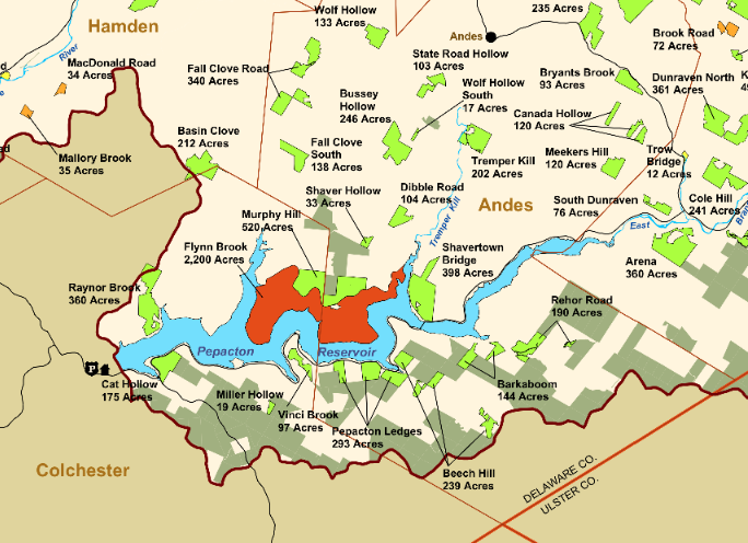
Below: Detail from a DEP map of public access lands in the Catskill Park, showing both city- and state-owned lands that are open to recreation. Click on the map to open a bigger version in Flickr.
Below: A list from the DEP of the 5,977 acres that were opened up to public access in 2013:
Delaware County
- 212 acres on Basin Clove Road in Hamden and Colchester, opened as the new Basin Clove Public Access Area
- 138 acres on Fall Clove Road in Andes, opened as the new Fall Clove South Public Access Area
- 133 acres on Coss Road in Andes, opened as the new Wolf Hollow Public Access Area
- 103 acres on State Road in Andes, opened as the new State Road Hollow Public Access Area
- 322 acres on Gladstone Hollow and Doig Hollow Roads in Andes, opened as the new Gladstone Hollow Public Access Area
- 93 acres on Gun House Hill Road in Stamford, opened as the new Gun House Hill Public Access Area
- 150 acres in two acquisitions on Elk Creek Road in Meredith, opened as the new Elk Creek Public Access Area
- 17 acres on Wolf Hollow Road in Andes, opened as the new Wolf Hollow South Public Access Area
- 46 acres on Glen Burnie Road in Delhi, opened as the new Glen Burnie Public Access Area
- 87 acres on Pines Brook Road in Walton, opened as the new Pines Brook Public Access Area
- 132 acres on Murphy Hill Road in Walton, opened as the new More Park Public Access Area
- 154 acres on Shaver Hollow Road in Andes, opened as the new Pepacton Plateau Public Access Area
- 118 acres on County Route 2 in Andes, opened as the new Hemlock Knolls Public Access Area
- 80 acres on State Rte 30 in Andes, opened as the new Perch Lake Public Access Area
- 292 acres added to the Bagley Brook Public Access Area on County Route 2 in Delhi
- 137 acres added to the Utsayantha Public Access Area on NYS Rte 23 in Stamford
- 110 acres added to the Bloomville Public Access Area on River Road in Stamford
- 46 acres added to the Plattekill Mountain Public Access Area on Lower Meeker Hollow Road in Roxbury
- 93 acres added to the Shavertown Bridge Public Access Area on NYC Hwy 30A in Andes
- 64 acres added to the Utsayantha Public Access Area on Tower Mountain Road in Stamford
- 50 acres added to the Buffalo Hollow Public Access Area on George Lawrence Road in Roxbury
- 33 acres added to the Weaver Hollow Public Access Area on Weaver Hollow Road in Middletown
- Couse Hill, Bob’s Brook, Peakes Brook, Township Valley, Duggan Hill, West Schoharie, Red Kill and Dunraven North EBP areas all converted to PAAs totaling 1,508 acres
Greene County
- 592 acres on Brush Road in Lexington, opened as the new Pine Island Mountain Public Access Area
- 226 acres in two acquisitions on NYS Rte 23 in Ashland, opened as the new Campbell Road Public Access Area
- 194 acres on Mill Road in Windham, opened as the new Bump Mountain Public Access Area
- 75 acres in two acquisitions off NYS Rte 23A in Hunter, opened as the new Twilight Park Public Access Area
- 53 acres added to the Jennie Notch Public Access Area on Old Road in Windham
- 124 acres added to the Little Westkill Public Access Area on County Route 2 in Lexington
- 268 acres added to the Cozy Hollow Public Access Area on Dump & Dent Roads in Prattsville
- 52 acres added to the East Windham Public Access Area on NYS Rte 23 in Windham
- The 110 acre West Halcott unit on Red Kill Road in Roxbury and Halcott was converted from EBP to Public Access Area
Schoharie County
- 36 acres on Wood Road in Conesville, opened as the new Wood Road Public Access Area
- 115 acre Bearkill EBP area converted to PAA and added to the Manorkill Public Access Area
Ulster County
- 31 acres added to the Yagerville Road Public Access Area on Yagerville Road in Denning
Sullivan County
- 34 acres on Moore Hill Road in Neversink, opened as the new Western Road Entry By Permit Area
- 5 acres added to the Sugarloaf Public Access Area on Sugar Loaf Road in Neversink


