


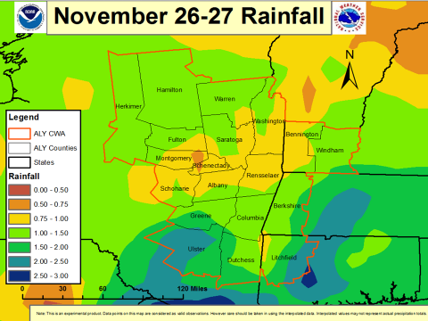
Above: Rainfall totals for the storm so far, posted to Facebook by the National Weather Service station in Albany around 10:30 a.m. Wednesday morning.
Rainfall has been heavy in the Catskills during the storm that began Tuesday afternoon. Most areas in the region have received 1 to 2 inches so far, with localized rainfall of around 3 inches in higher elevations in Ulster County. Rain will continue into the afternoon, with about another half-inch expected to fall.
A flood watch issued on Tuesday is still in effect for Ulster and Greene counties in the Catskills region, along with a portion of the mid-Hudson Valley and parts of New England.
Drivers should watch out for fast-changing road conditions. Through the afternoon and into the evening Wednesday, roads in the area may ice over as the temperature drops quickly and rain shifts to sleet and snow.
The flood watch is in effect until 6 p.m., according to a message posted Wednesday morning on NY-Alert by the National Weather Service in Albany.


